On July 25, Costa Rica will stage a raucous celebration marking the 199th anniversary of the annexation of Guanacaste in 1824 — a stunning diplomatic coup that dramatically increased Costa Rican territory and fundamentally transformed the nation.
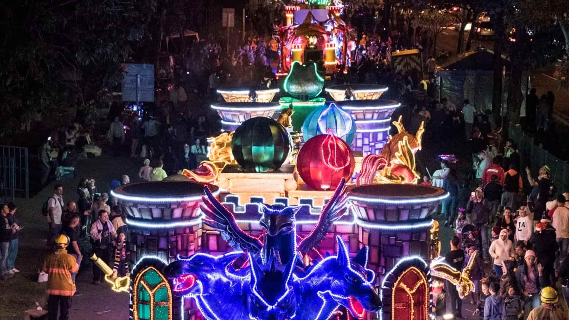
This national holiday is marked every year by street parades with traditional dancers, marching bands, bull-riding rodeos and processions of magnificent horses. Crowds throng the roadsides to watch, vendors hawk food and drink, and everyone takes a break from their daily life because a carnival has come to town.
So what exactly is the occasion we’re celebrating? Any Tico will tell you this is the date Guanacaste voted to sever its ties with Nicaragua and become part of Costa Rica. And that is mostly true, but there are many misunderstandings about what actually happened, and the full story is little known.
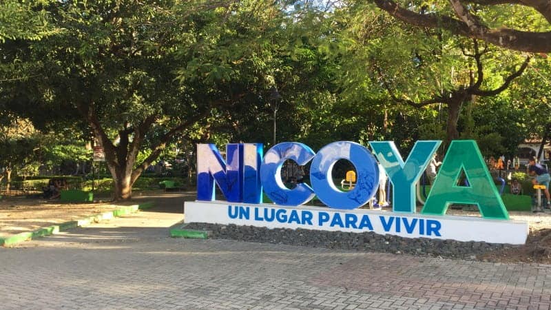
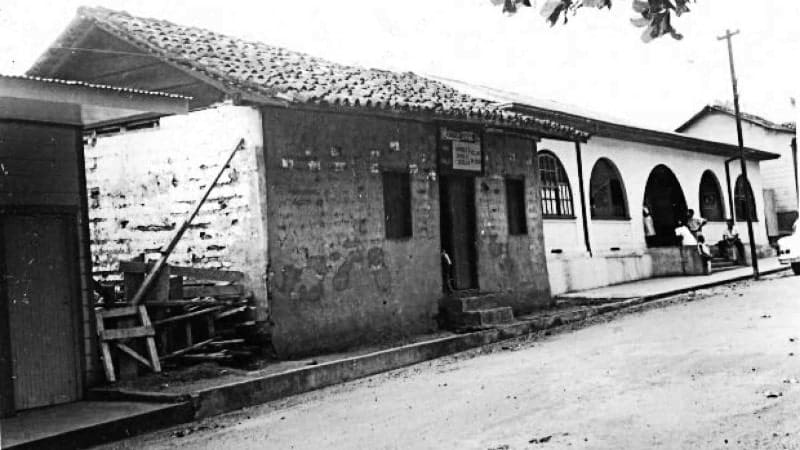
The region called Guanacaste today was known for centuries as Nicoya, named by the Spanish after an indigenous chief. The holiday is known formally as the “Anexión del Partido de Nicoya,” (Annexation of the Party of Nicoya), and it’s sometimes called “Anexión de Nicoya,” “Anexión de Guanacaste” or just “Guanacaste Day.” And if you think a holiday with four names is confusing, wait till you hear the backstory.

One oddity is that this was not an annexation, which implies that the territory was seized by appropriation against its will. Another oddity is that Guanacaste was then the name of the city now called Liberia, and that was the only city that voted against the proposal to join Costa Rica. It’s also worth noting that the process whereby all of Guanacaste became incorporated into Costa Rica did not happen on one date and actually spanned years.
But the biggest misconception about this holiday is that Guanacaste had always been part of Nicaragua, and that by joining Costa Rica in 1824 it was abandoning its ancestral homeland. In fact, Guanacaste was completely autonomous for the great majority of its history, including one period of 184 years. For much shorter periods, it also fell under the jurisdiction of both Nicaragua and Costa Rica, which sometimes batted it back and forth like a ping-pong ball.
Here’s a short version of a long but interesting story.
In the beginning
In 1513, just 21 years after Columbus landed in America, Nicoya was already part of a disputed border in a Spanish holding called Castilla de Oro that stretched all the way south to Colombia. Even in its infancy, the future Guanacaste straddled a fence between competing claims.
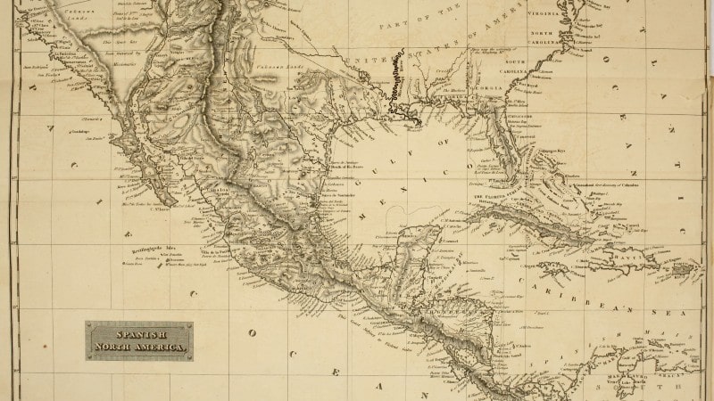
In 1527, Spain established the Province of Nicaragua, which included the Kingdom of Nicoya. The latter was an indigenous chiefdom, a cacicazgo ruled by an elected king in a complex society with specialized agriculture and an advanced state of cultural development.
In 1554, the Corregimiento de Nicoya was separated from the Province of Nicaragua and became an independent entity. The Province of Costa Rica was established in 1573, and 15 years later, Nicaragua, Costa Rica and Nicoya were all granted autonomy to rule themselves.
In 1593, Nicoya came under Costa Rican control for the first time when the governor of Costa Rica was appointed High Mayor of Nicoya also. But in yet another change of fortunes, in 1602 the High Mayor was declared autonomous of Costa Rica — and remained so for the next 184 years. Nicoya was answerable only to the Royal Audience of Guatemala, the seat of Spanish rule in Central America.
In 1786, the tables were turned as Nicoya fell under Nicaraguan jurisdiction, but in 1820, they were turned again! Costa Rica and Nicaragua were reestablished as provinces of the Spanish crown, but they were separated into seven “parties”: Segovia, El Realejo, León, Granada, Nicaragua (Rivas), Nicoya and Costa Rica.
Which brings us to 1821, a watershed year for all of Central America. The 11-year Mexican War of Independence ended with the total collapse of Spanish rule in Mexico and all of Central America. On Sept. 15, the Act of Independence of Central America declared Guatemala, Honduras, El Salvador, Nicaragua and Costa Rica liberated from outside rule. It actually took a month for news to reach Costa Rica that it was now independent.
One holdover from Spanish rule was a Provincial Council that oversaw the affairs of the seven “parties” in Nicaragua and Costa Rica. But on Dec. 1, Costa Rica declared itself separate from Nicaragua and withdrew from the Provincial Council. Six other parties remained subject to the Provincial Council, including Nicoya, which at this time was considered part of Nicaragua.
But two years after independence, all hell broke loose in Nicaragua. Liberals took up arms against a conservative government that wanted to join the Mexican Empire, and Nicaragua was brutalized by civil war from 1823 through 1824, and again in 1827-29.
Even Costa Rica had a little civil war in 1823, lasting one month and ending in a one-day battle in which 20 people died. This was between forces in Cartago that wanted to join the Mexican Empire and forces in San José that didn’t. If you can name Costa Rica’s capital today, you’ll know who won.
Despite these brief hostilities, Costa Rica was a bastion of peace and safety compared to its wartorn neighbor to the north. If Nicoya was shopping for a country to belong to, Costa Rica was looking better all the time.
Divided loyalties

“Nicoya,” as noted, was the name used at the time for what is today called Guanacaste, while Guanacaste was the name of the city now called Liberia. The “Party of Nicoya” consisted of three population centers:
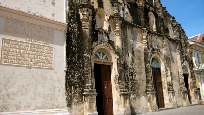
• Nicoya, 100 miles from the modern Nicaragua border, had close political and economic ties to Costa Rica, benefiting especially from its port at Puntarenas. Officials from Nicoya, in fact, had long sent representatives to the Costa Rican capital to cast votes on key issues, as if it were already part of the country.
• Santa Cruz, 15 miles from Nicoya, was a smaller town that had the same commercial and trade ties to Costa Rica.
• Guanacaste (Liberia) had closer economic and political ties to Nicaragua, which was just 50 miles away, especially among influential ranching families of Spanish descent.
In March 1824, Costa Rica first formally proposed that Nicoya voluntarily incorporate itself into the country. An open meeting was held in Nicoya to discuss the proposal, but attendees declined the offer on the grounds that the Party of Nicoya could not be a “dissident.”
By July, those reservations had been resolved. A vote was held in the city of Nicoya on July 25 — our magic date — and the proposal was overwhelmingly approved by a reported 77% margin. Three days later, Santa Cruz voted along the same lines.
Only the city of Guanacaste (Liberia) voted the proposal down, influenced by its close ties to Nicaragua. But eventually, even Guanacaste threw caution to the wind and jumped on the Costa Rica train. In 1826, the congress of the Federal Republic of Central America declared the entire Party of Nicoya to be part of Costa Rica, including Guanacaste.
The package was now complete, all the groundwork laid for the formation of the modern-day Province of Guanacaste in 1848. It included the territories of Bagaces and Cañas, which had always been Costa Rican, plus Nicoya, Santa Cruz, and Guanacaste (which changed its name to Liberia in 1854).
The upshot
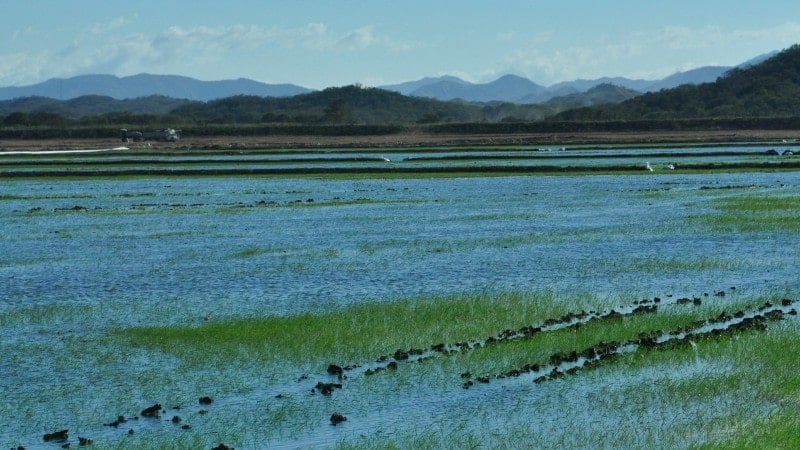
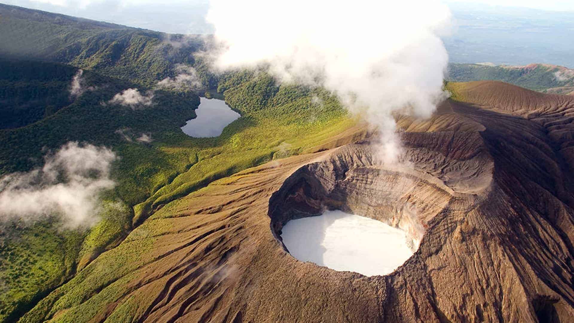
Costa Rica had pulled off a masterstroke of diplomacy, gaining control of a vast, fruitful region without a shot fired or a penny paid. Guanacaste was a bread basket of rice, sugarcane and sorghum, but was best known for the cattle ranches that dotted its vast plains.
The rest of Costa Rica welcomed Guanacaste with open arms, and was charmed and fascinated by its rugged cowboy culture. Costa Rica had found its Wild West, and in the years ahead would embrace its frontier traditions as an inseparable part of the national heritage.
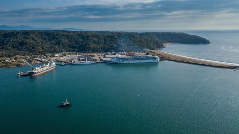
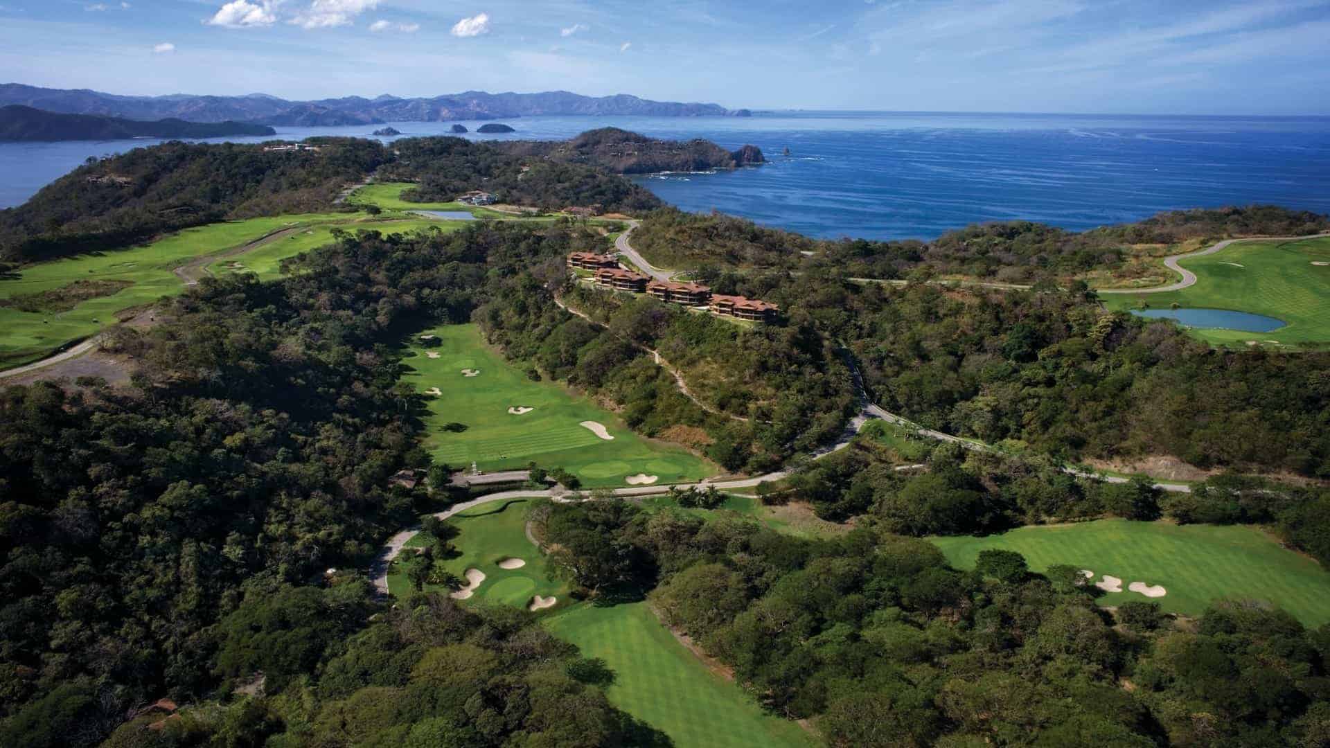
Almost 4,000 square miles in size (one-fifth of the land area of Costa Rica today), Guanacaste was a huge addition to the national territory. But at the time these sleepy pastures changed hands, nobody could have foreseen the unthinkable wealth in tourism revenue this region would generate someday.

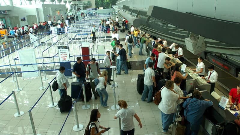
More than 660,000 people flew into the Liberia airport in 2022, some 31% of all arrivals by air in Costa Rica. In other words, almost one-third of international visitors are deliberately flying to Guanacaste, and they don’t come here as a jumping-off point to elsewhere, but as their chosen destination. The enormous influx of tourism wealth these visitors bring with them makes Guanacaste a primary driver of the Costa Rican economy.
Just consider some of the people magnets that could have been part of Nicaragua today: Playas del Coco, Flamingo, Tamarindo, Nosara, Sámara. If not for Guanacaste, maybe Costa Rica would have been called Costa Chica.
Guanacaste’s inspirational state motto, emblazoned on its official seal, affirms its deliberate choice in joining Costa Rica: “De la patria por nuestra voluntad” — “Of the homeland by our own will.”
So happy 199th, Guanacaste! We know you have a choice when you need a country, and we thank you for choosing Costa Rica.

One Response
It goes without saying because of the historic ethnic and social ties of the people in the region, that the Guanacaste region has many ties to Nicaragua, so much so, that anyone familiar can easily mistaken the people in the area for those you find in towns throughout Nicaragua. Nicaragua because of its modern history and being engulfed in war and poverty over the last decades, has not been able to become a player in writing history based on its rich history but the point I want to make is that Nicaragua and the Guanacaste share many similarities in its people, culture, and way of life. This includes beaches, food and albeit if not for war, life longevity and the blue zone theory. The beaches along the Nicaraguan coast would be as developed as those you find in Guanacaste if not for Nicaragua’s turbulent recent history.